
Manage Fishing Territories – Save Your Fishing Spots with GPS
If you regularly fish at different waters, territories help you organize your fishing sessions and generate water-specific statistics. You can manage every fishing territory and save your fishing spots with GPS coordinates – the foundation for an individual territory-based analysis while fishing.
Your territories are the basis for the individual assessment of fishing conditions. AngelStratege calculates fishing conditions and the weather trend separately for each territory and evaluates your previous sessions specifically for that area – giving you an assessment tailored to your actual fishing spots.
What Is a Territory?
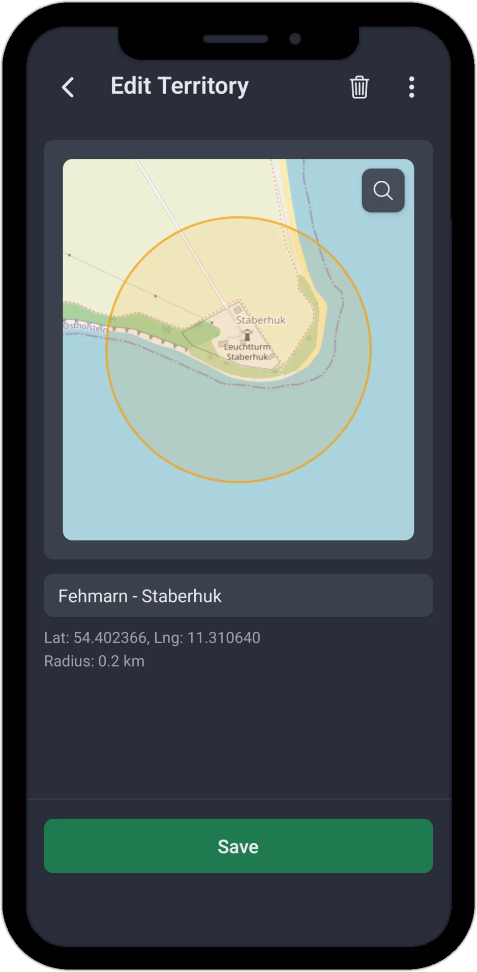
A territory is a circular area you define on the map, with a center point and a radius. It can be your favorite fishing spot with a radius of about 100 meters, an entire lake or a river section, or a larger area covering several of your favorite waters.
Creating a Territory: Map Excerpt Instead of a Form
While creating a territory, a circle stays fixed in the center of the screen – you pan and zoom the map beneath it until the circle covers exactly the area you want to save as a territory. The radius is calculated automatically from the zoom level you choose, so there's no manual input or slider needed. The location search lets you jump straight to a specific place; if your current GPS position falls inside the circle, the app also marks it on the map.
For each territory you set:
- Name: a meaningful name for the water
- Map excerpt: center point and radius, set by panning and zooming the map
Manage Your Territories
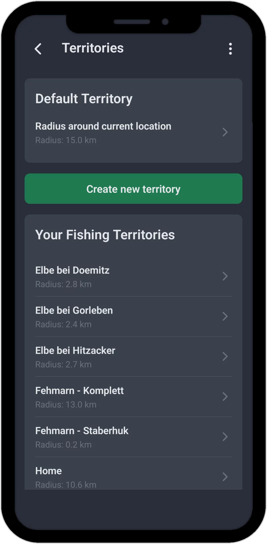
The Territories list shows all your fishing territories with their respective radius at a glance. AngelStratege also automatically creates a Default Territory – a radius around your current location with a configurable size, which applies whenever you haven't yet created a territory of your own for a place. There is no limit to how many territories you can create.
Territory-Specific Statistics
Territories let you filter your statistics precisely:
- How successful am I at which water?
- Which fish species do I catch most often, and where?
- Are there differences in the best fishing times between waters?
Tip: Feel free to create several territories for a single water – for example one for shallow water and another for deeper areas. If two territories overlap, AngelStratege automatically assigns a session to all matching territories, not just the nearest one. That way you can precisely compare differences in fishing success across seasons and conditions. You can also optionally create an additional territory covering the entire water, or several of your waters together.
Why Territory-Based Analysis? – The Core of AngelStratege
What sets AngelStratege apart is its territory-based analysis. While other fishing apps deliver generic weather ratings, AngelStratege calculates fishing conditions and the weather trend individually for each territory. What counts as good fishing conditions on one lake can look completely different on a river.
As soon as you save a session, AngelStratege automatically assigns it by GPS position to all matching territories – with no manual selection required. For every territory involved, the session immediately feeds into that territory's experience statistics: the app uses the local weather data specifically for that area and compares it with your previous sessions there. The result is a water-specific statistic built entirely on your own fishing data.
The more fishing spots you save with GPS coordinates and the more sessions you record at a territory, the more precise its statistics become. You can evaluate your fishing success per territory and, over time, you'll see which weather conditions produce the best results at each of your fishing territories – so you can plan your next fishing day accordingly. That's territory-based analysis built on your own data.
Start Now – Try the Fishing App for Free
Ready to analyze your fishing spots in detail?
The app already comes with extensive test data from 2 years of fishing – so you
can see right away what AngelStratege can do. No email, no password, no hassle.

